See Travel information page for help getting to Bleadon. Click here to Locate Map Reference, Calculate an Area or use North Somerset Council Services Map or NSC GIS Map Also here is useful sketch street map. More mapping applications can be found here. View Larger Map |
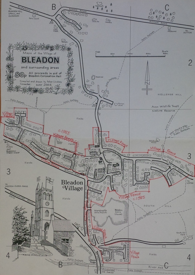
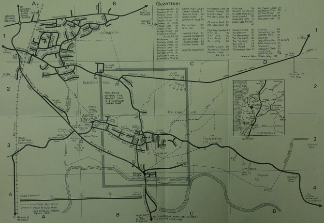
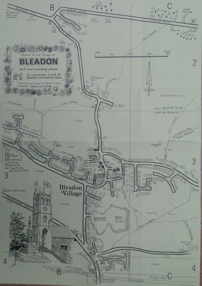
For your convenience, below is a useful sketch street map and gazetteer of Bleadon and surrounding area produced by Peter Lindsay also one showing the 'village fence' (NSC planning settlement boundary), current map copies can be obtained locally at Post Office and Country Stores


